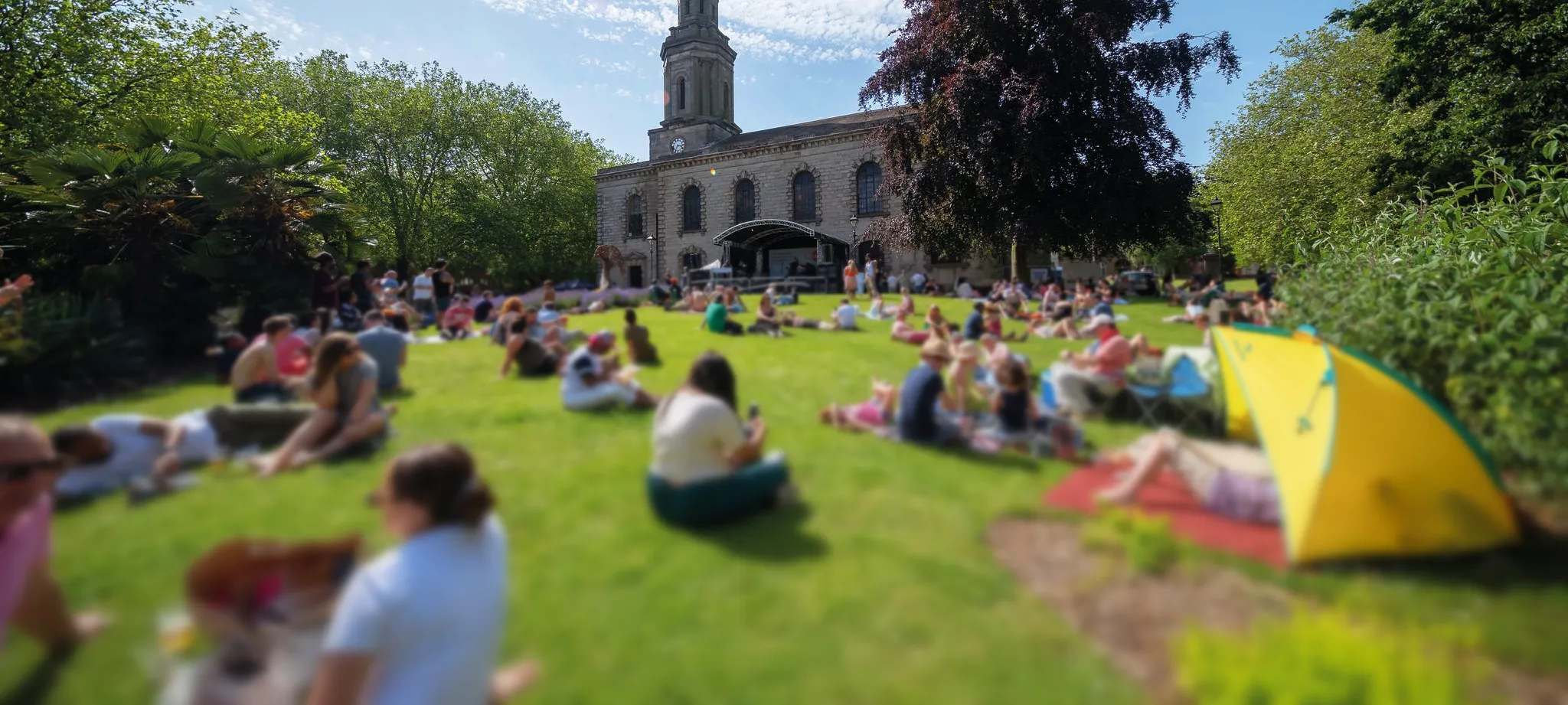
The Jewellery Quarter is one of Birmingham’s most distinctive districts, but it is not always easy to navigate. For visitors, routes into and through the area can feel confusing, with limited signage, unclear landmarks, and few cues explaining where you are or what lies ahead. For residents and students, the Quarter can feel fragmented: full of character, but lacking a clear sense of layout, boundaries, and connection.
As the area continues to grow, improving physical wayfinding has become increasingly important. Finding Your Way: Signage was developed to make the Jewellery Quarter easier to explore, easier to understand, and easier to feel part of. The aim was not simply to add more signs, but to create a coherent system of maps, routes, and area identities that connects people to the places, stories, landmarks, and everyday destinations that make the Quarter special.
This part of the Finding Your Way project focused on three key groups whose needs helped shape the work.
Together, these groups showed what the signage and mapping work needed to achieve. It needed to make arrival more intuitive, exploration easier, and orientation more natural. It also needed to reveal the Quarter’s layout and character in a way that helps people understand not just where they are going, but where they are.
Rather than relying on broad public consultation alone, this part of the project was developed through a focused working group made up of people with detailed knowledge of the area.
The process brought together residents, businesses, local partners, and civic stakeholders to directly shape how the Jewellery Quarter should be divided into areas, how routes should connect, where signage should be placed, and how physical and digital wayfinding could work together.
This approach ensured that the work was grounded in practical local knowledge rather than abstract planning. It also meant that decisions about maps, naming, and navigation reflected the lived experience of the people who know the area best.
The working group process was designed to create three practical outputs that together form the foundation of a future wayfinding system.
The first was an Area Names and Descriptions List: a shared framework for how different parts of the Jewellery Quarter are named, described, and represented across signage, maps, and digital platforms. This creates a common language for the area and helps tell a more joined-up story about its different zones and identities.
The second was a Digital Map of Routes and Sign Locations: a practical map showing key zones, main pedestrian routes, entrances, landmarks, and proposed locations for signs, boards, and map points. This provides an operational base for future delivery and investment.
The third was a Design Brief for Maps and Signage: a concise specification for how the wayfinding system should look, feel, and function. This includes visual identity, layout, accessibility, material considerations, and continuity with wider communications and digital platforms.
Together, these outputs created a blueprint for a signage and mapping system that is clear, coherent, accessible, and rooted in the identity of the Jewellery Quarter.
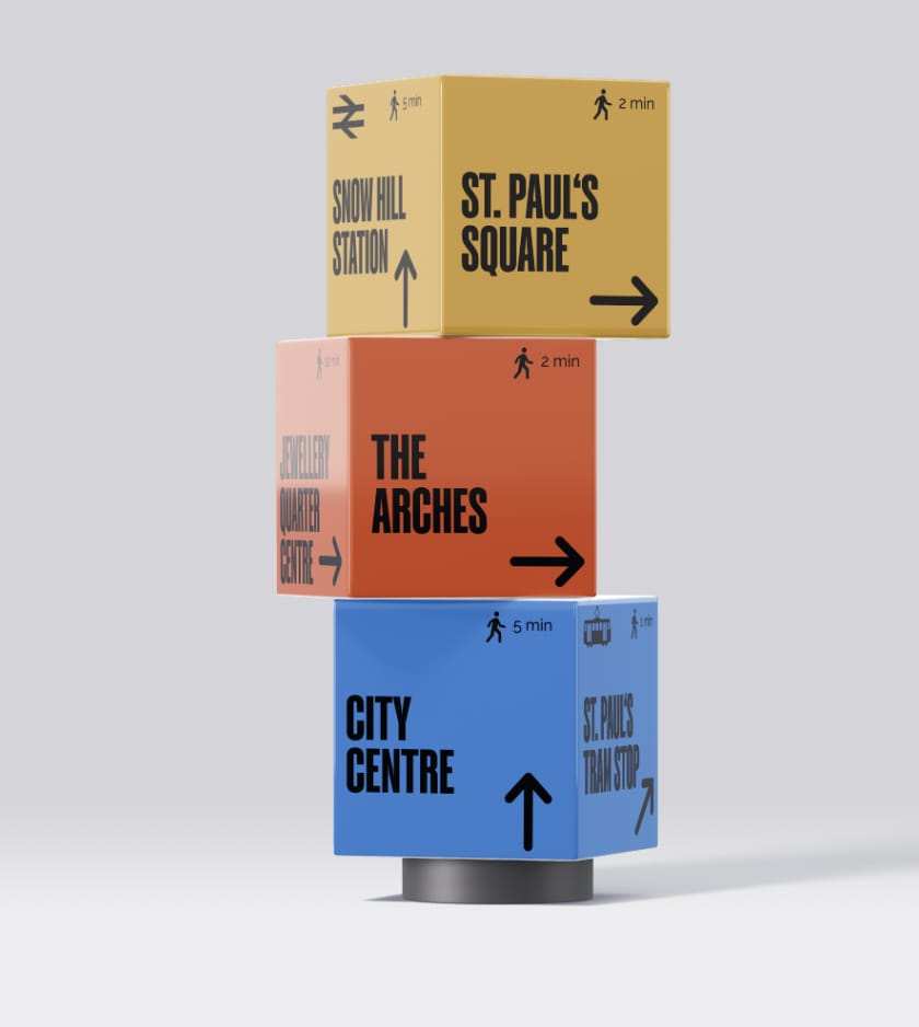
The visual design for the signage was led by Lisa Barrett, who helped translate the working group’s thinking into a bold and recognisable public-facing concept. The group chose to use the Jewellery Quarter BID’s branding as the basis for the signage system, creating stronger consistency for people moving between the physical environment and the BID’s visitor-facing digital platforms. This decision helped ensure that visitors encountering the area on the ground would find a familiar visual language when using the BID’s website and materials.
The signage itself takes the form of striking cubes, creating a distinctive presence in the public realm while allowing for clear wayfinding information and strong visual recognition. Navigation routes were designed to take people through some of the best and most scenic parts of the Quarter, helping the system do more than move people efficiently from A to B. It also encourages exploration, discovery, and a richer experience of the area’s character.
A key part of the thinking behind the project was longevity. While the visual treatment of signage may need refreshing every five years or so, the underlying structure, the routes, area identities, map logic, and placement strategy, is intended to have a much longer life. In practice, the location and mapping framework could support the Quarter for a decade or more, giving local partners a strong strategic base for future updates and investment.
This makes the project more than a design exercise. It is long-term place infrastructure: a practical system for how the Quarter explains itself to the people moving through it.
The signage project was delivered through collaboration between the JQ Neighbourhood Forum, Lisa Barrett, the Jewellery Quarter BID, Claudine Ratnayake, Quartermasters and a wider working group of local voices.
Quartermasters facilitated the workshops, documented the outputs, and translated local knowledge into usable plans and briefs. The JQ Neighbourhood Forum helped shape the wider civic and resident-focused ambitions of the work. Lisa Barrett developed the design direction for the signage itself. The Jewellery Quarter BID brought in a strong understanding of the public realm, visitor experience, and delivery context. Together, this created a process that balanced identity, usability, heritage, and practical implementation.
The project is also designed to grow. An application has been made for Phase Two funding, which would extend the signage system further from east to west across the Quarter. This next phase would not only expand the physical wayfinding network, but also support wider community capacity by funding a staff role to help organise volunteers in the area.
That means the signage project is not just about navigation. It is part of a bigger effort to strengthen how people move through, connect with, and take ownership of the Jewellery Quarter.
The outcome of this project is a clear blueprint for how the Jewellery Quarter can be navigated and understood more easily in future.
It establishes the foundations for signage, maps, digital links, heritage interpretation, and area identity to work together as one joined-up system. More than that, it helps define how the Quarter presents itself to the world: not as a confusing patchwork of streets, but as a connected, characterful neighbourhood with its own story, landmarks, and sense of place.
That is what Finding Your Way: Signage is really about: helping people not just pass through the Jewellery Quarter, but properly read it.